Paved path · Road bike
River Mountains Loop Trail
The 34-mile paved River Mountains Loop around Henderson, Boulder City and Lake Mead: trailheads, where to find water, the climbs and park fees.
Updated Oct 22, 2026 · 7 sources · road bike, e-bike
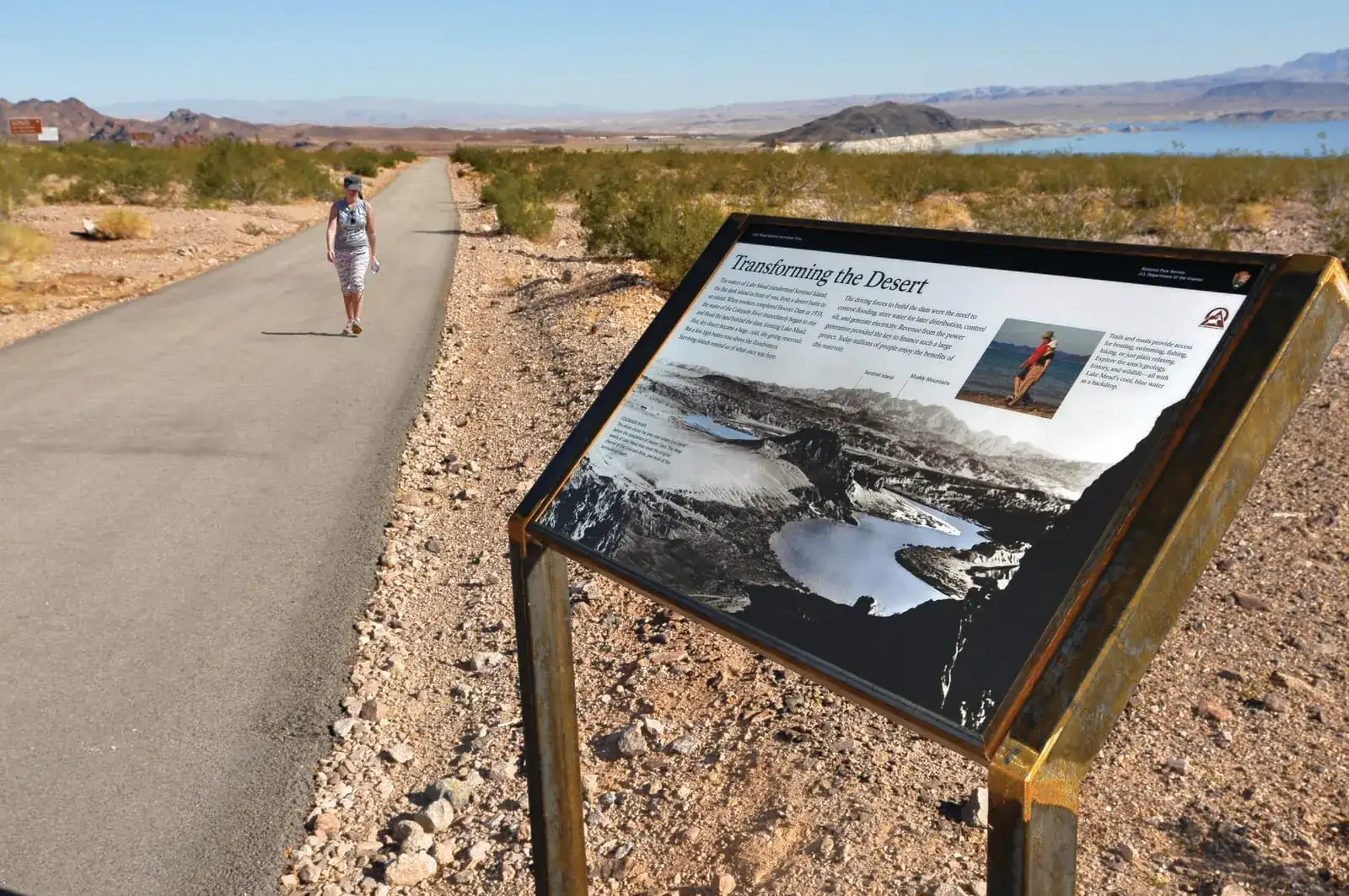
Photo: Lake Mead NRA Public Affairs / Wikimedia Commons, CC BY-SA 2.0

- Distance
- About 34-mile loopSource: River Mountains Loop Trail: about the trail
- Climbing
- Elevation varies by 1,300+ ft, high point to lowSource: River Mountains Loop Trail: trailheads and maps
- Surface
- Paved and concrete, 12 ft wideSource: River Mountains Loop Trail: about the trail
Each stat shows its source. We only list figures a land manager or named source publishes; a missing stat means we found no published figure.
Conditions at the start
NWS forecast for this spot ↗The live National Weather Service forecast for the start of River Mountains Loop Trail loads here. If it doesn't, use the NWS link.
Route map
Skip the map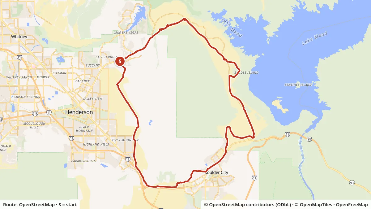
- Mapped distance
- 34.4 mi loopMeasured along the OpenStreetMap line; published figure: About 34-mile loop
- Start
- Mountain Lake Park, 1020 Golda Way, Henderson (one of many trailheads)Map start: Mountain Lake Park, 1020 Golda Way, Henderson
- Elevation
- 1,220–2,689 ftLow and high points, USGS 3DEP
- Surface
- 92% paved, 8% not taggedFrom OpenStreetMap surface tags
Slide or use arrow keys to read the elevation at any point.
Turn by turn
- 0.0 miStart at Mountain Lake Park, 1020 Golda Way, Henderson. Head northeast on River Mountains Loop Trail.
- 0.3 miPass the junction with Lake Mead Parkway Trail.
- 0.7 miCross Moonlark Road.
- 1.2 miPass the junction with Lake Mead Parkway Trail.
- 14.9 miCross Hemenway Road.
- 15.9 miPass the junction with Historic Railroad Trail.
- 18.4 miPass the junction with Boulder City Branch.
- 19.6 miPass the junction with River Mountains Loop Trail - Pacifica Way Trailhead.
- 20.2 miPass the junction with River Mountains Loop Trail - Ville Drive Trailhead.
- 20.8 miCross Saint Jude's Street.
- 22.2 miPass the junction with Bootleg Canyon Road.
- 23.9 miCross Veterans Drive.
- 26.8 miPass the junction with Union Pacific Railroad Trail.
- 27.6 miPass the junction with Old Vegas Trail.
- 29.1 miPass the junction with Equestrian South Trail.
- 30.8 miPass the junction with Burkholder Trail.
- 34.4 miYou are back at the Mountain Lake Park trailhead.
Directions are generated from the OpenStreetMap ways on the map. Check signs and closures with River Mountains Loop Trail: trailheads and maps before you ride.
Download GPX for River Mountains Loop TrailPlan your own ride
Rules, fees and who runs it
- Managed by
- Trail partnership; city and NPS land
- Bicycle entry
- Lake Mead fee applies inside the park ($15)
- Motor vehicles
- None: walking, biking, some horse sections
The River Mountains Loop is the closest thing Las Vegas has to a long, car-free road ride. It’s a paved path that circles the River Mountains, connecting Henderson, Boulder City, Lake Mead National Recreation Area and the Hoover Dam area. There are no cars on it and no shoulders to argue about, just a 12-foot-wide path and a lot of desert.
The basics
The trail partnership puts the loop at about 34 miles. The segments are paved or concrete and 12 feet wide, built for walkers and road cyclists, and some stretches have a separate horse trail alongside. It’s non-motorized. The first segments were dedicated in 2000 and 2001, and the full loop was completed in the fall of 2012.
It isn’t flat. The trail site says the elevation varies by more than 1,300 feet between its high and low points, with a few steep sections that are short. Locals know the climbs well: the trail’s own social posts call the “Three Sisters” grueling. On a road bike, gear for the climbs and expect the descents to come up fast on a path you’re sharing with walkers.
Where to start
The trail site lists trailheads in three groups. A few of the most useful ones for cyclists:
| Trailhead | Area | Water? | Notes from the trail site |
|---|---|---|---|
| Alan Bible Visitor Center / Historic Railroad trailhead | Lake Mead NRA, US 93 at Lakeshore Drive | Yes, at the visitor center | Shared with the Historic Railroad Trail. The lower lot is often full on weekends |
| Lake Mead Parkway fee station | Lake Mead NRA, from Henderson | No | Pit toilet, trash, kiosk |
| Mountain Lake Park, 1020 Golda Way | Henderson | Yes | Parking, restrooms, shade |
| Equestrian Park, 1699 Equestrian Dr | Henderson | Not listed | Restroom building at the end of the street |
| Railroad Pass Hotel & Casino, 2800 S Boulder Hwy | Between Henderson and Boulder City | Inside the casino | Trailhead in the upper parking lot |
| Bootleg Canyon Park | Boulder City | Half a mile uphill | Water and restrooms at the mountain bike trailhead |
| Pacifica Way, 600 Pacifica Way | Boulder City at the park boundary | No | Primitive |
Boulder Harbor, inside the park between Boulder Beach and the water treatment plant, is an access point with restrooms and water right where the trail crosses the entry road. Plan your refills from this table rather than counting on finding water along the way.
Fees and park rules
The trail site mentions an entry charge only on its Lake Mead page. The trailheads inside Lake Mead National Recreation Area sit behind the park’s fee system: the trail site notes a charge for vehicles entering the park, and the NPS says bicycles are subject to the entrance fee as well. A pass for one person on a bike costs $15 for 1 to 7 days. See Lake Mead fees and roads for the full table and where to buy.
Lake Mead’s Superintendent’s Compendium formally designated the River Mountains Loop Trail inside the park for bicycles, including e-bikes, on September 28, 2021. The federal park rules for bikes apply there, including lights in low visibility and no riding side by side.
Adding the Historic Railroad Trail
The Historic Railroad Trail branches off the loop near the Alan Bible Visitor Center and runs 3.7 miles to Hoover Dam through five tunnels. It’s fine gravel rather than pavement, so it suits wider tires.
When to ride
October through April is comfortable. In summer, start at sunrise and carry more water than you think you need. Read the heat guide before a warm-weather loop.