Road climb · Motorcycle
Climbing Mt Charleston on Kyle Canyon Road
The road climb from US-95 up Kyle Canyon to the Spring Mountains Visitor Gateway: about 16 miles from desert to pine forest, with water at the top.
Updated Oct 22, 2026 · 4 sources · road bike, motorcycle
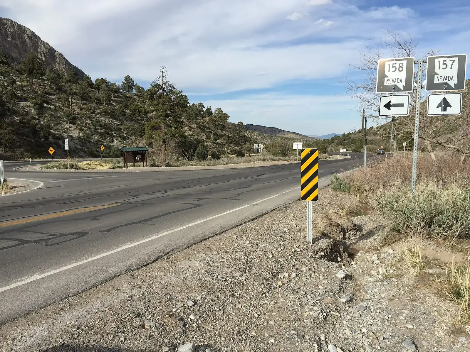
Photo: Famartin / Wikimedia Commons, CC BY-SA 4.0

- Distance
- About 16 mi one way to the Visitor GatewaySource: USDA Forest Service: Spring Mountains Visitor Gateway
- Best season
- Visitor Gateway open year-roundSource: USDA Forest Service: Spring Mountains Visitor Gateway
Each stat shows its source. We only list figures a land manager or named source publishes; a missing stat means we found no published figure.
Conditions at the start
NWS forecast for this spot ↗The live National Weather Service forecast for the start of Climbing Mt Charleston on Kyle Canyon Road loads here. If it doesn't, use the NWS link.
Route map
Skip the map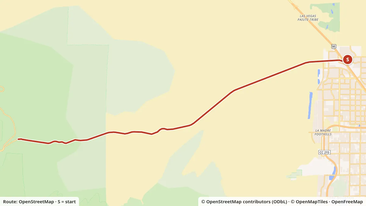
- Mapped distance
- 16.7 mi, start to finishMeasured along the OpenStreetMap line; published figure: About 16 mi one way to the Visitor Gateway
- Start
- US-95 at Kyle Canyon Road (NV-157)Map start: US-95 at Kyle Canyon Road (SR-157), where SR-157 begins
- Elevation
- 2,766–6,638 ftLow and high points, USGS 3DEP
- Surface
- 100% pavedFrom OpenStreetMap surface tags
Slide or use arrow keys to read the elevation at any point.
Turn by turn
- 0.0 miStart at US-95 at Kyle Canyon Road (SR-157), where SR-157 begins. Head west on Kyle Canyon Road (SR-157).
- 0.5 miPass the junction with Oso Blanca Road.
- 0.9 miPass the junction with North Alpine Ridge Way.
- 1.2 miPass the junction with North Shaumber Road.
- 8.8 miPass the junction with Prospect Springs Road.
- 12.9 miPass the junction with Harris Springs Road.
- 15.4 miPass the junction with Telephone Canyon Loop Road (FR 45530A).
- 16.7 miYou reach the Spring Mountains Visitor Gateway on the right.
Directions are generated from the OpenStreetMap ways on the map. Check signs and closures with USDA Forest Service: Spring Mountains Visitor Gateway before you ride.
Download GPX for Climbing Mt Charleston on Kyle Canyon RoadPlan your own ride
Rules, fees and who runs it
- Managed by
- USDA Forest Service (Spring Mountains NRA)
- Bicycle entry
- No fee at the Visitor Gateway
- Water at the top
- Potable water and flush toilets at the Gateway
- Visitor center
- 9 a.m. to 4 p.m.
The climb up Kyle Canyon is the big one for Las Vegas road riders. You start in creosote desert on the edge of town and finish in pine forest, and on a summer morning the top can feel like a different climate. Motorcyclists ride the same road for the same reason. It’s all inside the Spring Mountains National Recreation Area, which the USDA Forest Service manages as part of the Humboldt-Toiyabe National Forest.
The numbers
The Forest Service gives directions to the Spring Mountains Visitor Gateway this way: go north on US-95 to NV-157, turn left, and go about 16 miles. That’s the climb. We pulled elevations for both ends from the U.S. Geological Survey’s elevation service:
| Point | Elevation (USGS) |
|---|---|
| US-95 at NV-157 (Kyle Canyon Road) | about 2,795 ft |
| Spring Mountains Visitor Gateway | about 6,634 ft |
Those are two spot elevations, not a measured climbing total, and no agency publishes one for this road. The profile under the map is sampled from USGS 3DEP along the road line. Ride it at your own pace the first time. The road continues past the Gateway, but we haven’t verified distances or elevations for the upper end, so this page stops at the Gateway.
At the top
The Gateway makes a good turnaround. The Forest Service lists:
- Potable water and flush toilets
- Picnic tables
- A visitor center open 9 a.m. to 4 p.m.
- Year-round, day use only
- No fee to visit the Gateway or the visitor center. Group picnic sites there are paid.
The Cliff Rose Trailhead is across NV-157 from the Gateway. For questions, the Spring Mountains NRA office is at 4701 N. Torrey Pines Dr. in Las Vegas, (702) 872-5486, open weekdays 8 a.m. to 4:30 p.m. and closed on federal holidays.
Other roads up the mountain
The Forest Service also manages sites along Lee Canyon and the Deer Creek Highway (State Highway 158), which runs between the canyons. Its Deer Creek Picnic Area sits about halfway along that highway. We haven’t verified mileage or grades for those roads yet, so we’re not publishing a route for them.
Weather
The Spring Mountains run from about 3,000 feet in the valleys to 11,918 feet at the top of Charleston Peak, according to the Forest Service. Temperatures drop as you climb, so a ride that starts hot in town can end cool at the Gateway. Bring a layer for the descent, which is long and fast.
The start is still the desert. NOAA’s 1991–2020 normals for Harry Reid International put the normal July high at 104.5°F. In summer, start early so the lower half of the climb is behind you before the heat builds. See the heat guide.
Before you go
Check the Forest Service’s Spring Mountains page for alerts and closures; some trailheads in Kyle Canyon were listed as closed when we checked. For the road rules on the way up, see Nevada bicycle laws and Nevada motorcycle laws.